TRAIL DIARIES EXCERPTS
Markers of Potawatomi Trail of Death
In the 1820s and 1830s, the federal government removed many Indians from their eastern native lands. Many Potawatomi groups were removed over those years. Some Potawatomi in northern Indiana refused to move west. This led to the 1838 Potawatomi Trail of Death, a forced walk of 800-plus Potawatomi from northern Indiana, across Illinois and Missouri, and into Kansas. Forty-two Potawatomi, mostly children, died. The four state legislatures collectively have declared the historic route of the 1838 Potawatomi Trail of Death to be a regional historic trail.
Historical Markers
The 1838 forced march of over 800 Potawatomi took two months, from September 4th through November 4th. Numerous entities, including Potawatomi families, Eagle Scouts, and historical societies, have placed many historical markers along the route through all four states of Indiana, Illinois, Missouri, and Kansas. Many of these markers were placed at nightly campsites whereas others mark places through which the entourage passed.
The historical markers closest to the Kansas City area and within the Kansas City area are listed below.
--Lake City, MO: entrance on north side along Highway 78 into Little Blue River Nature Center/Lake City Bicycle Park within Burr Oak Woods; walk along hiking-biking trail, go over bridge, take west path, marker is beside trail
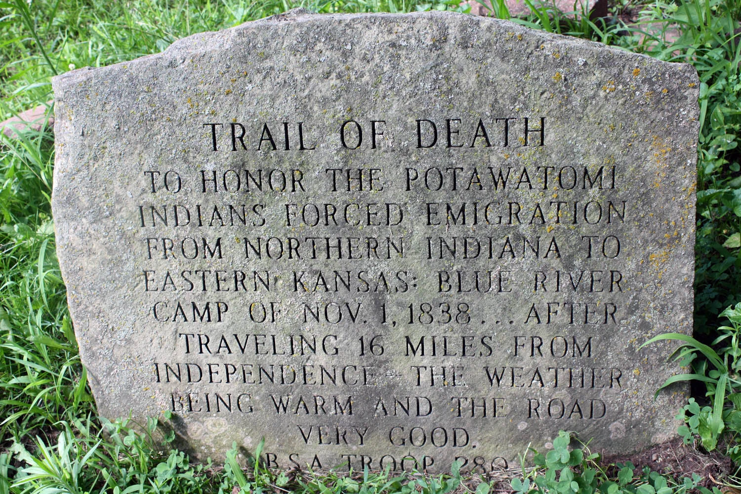
--Independence, MO: beside parking lot of Roger T. Sermon Center on Noland Road, just southeast of intersection of Truman Road and Noland Road; marker originally was placed beside Pioneer Spring Cabin, but the cabin was moved to the grounds of the National Frontier Trails Museum in the fall of 2019; marker was not moved
--Kansas City, MO: in Minor Park just south of Red Bridge Road on east side of Blue River, close to the river to the west of a shelter house
--Johnson County, KS (just south of Olathe): on northeastern edge of Heritage Park, just south of 159th Street along drive into park
--Paola, KS: in town square park called Park Square, north of fountain near a sidewalk; park on Pearl Street or Peoria Street
--Osawatomie, KS: beside modern small building that is supposed to look like the first land office in Osawatomie, on Lincoln Avenue
Directional Road Signs
Eventually a person will be able to follow Trail of Death directional road signs from Twin Lakes, Indiana (the beginning of the Trail of Death) to Osawatomie, Kansas (the end of the Trail of Death). This would allow a person to follow the general trajectory of the entire route of the forced walk on modern roads.
These directional road signs have been placed in Indiana, but many more directional road signs need to be placed in Illinois and Missouri.
In Kansas both Johnson County and Miami County to the south of Johnson County have placed the directional road signs.
You may see the route of these directional road signs across Johnson County by clicking on the following line.
Diarist Jesse C. Douglas, with his excerpts, is listed under the following three trail sites:
If you wish to read some diary excerpts associated with specific trail sites, please select from the List of Counties as trail diary excerpts are listed by county.