
Ironwoods Park is located at 147th and Mission Road, Leawood, KS. You will find a Tri-panel wood frame & wood post kiosk with 3 panels (re Oxford School etc…)
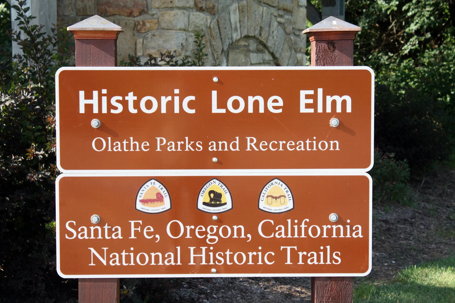


Lone Elm Park is located at 21151 167th St., Olathe, KS next to Lone Elm Road - Independence Route Campground. Here you will find multiple trails markers and wayside exhibits. Entry to the shelters/waysides is approximately ¼ mile east of Lone Elm Road.
“This site has been certified by the National Park Service as a historic site on the Santa Fe, Oregon and California trails. Enjoy this frontier campground where Kit Carson once slept. Wagon trains, “dragoons” (cavalry soldiers from Fort Scott and Fort Leavenworth), and many others made use of this ideally situated camping spot. Hike trails where emigrants and freighters camped, preparing for their journeys west. Explore native prairie wildflowers, too. The park, preserved by the City of Olathe, features interpretive signs that tell the story of Lone Elm campground, as well as recreational facilities, hiking trails, and an impressive stone-and-timber picnic shelter with reservations.” Excerpt from www.travelks.com


Gardner Junction Park is located at Highway 56 at 183rd St., a mile southwest of Gardner, Kansas. Here you will find 3 upright National Park Service (NPS) kiosks / 4 NPS wayside exhibits / 1 plaque on a low stone / 2 metal benches/ entry signs with 3 logos.
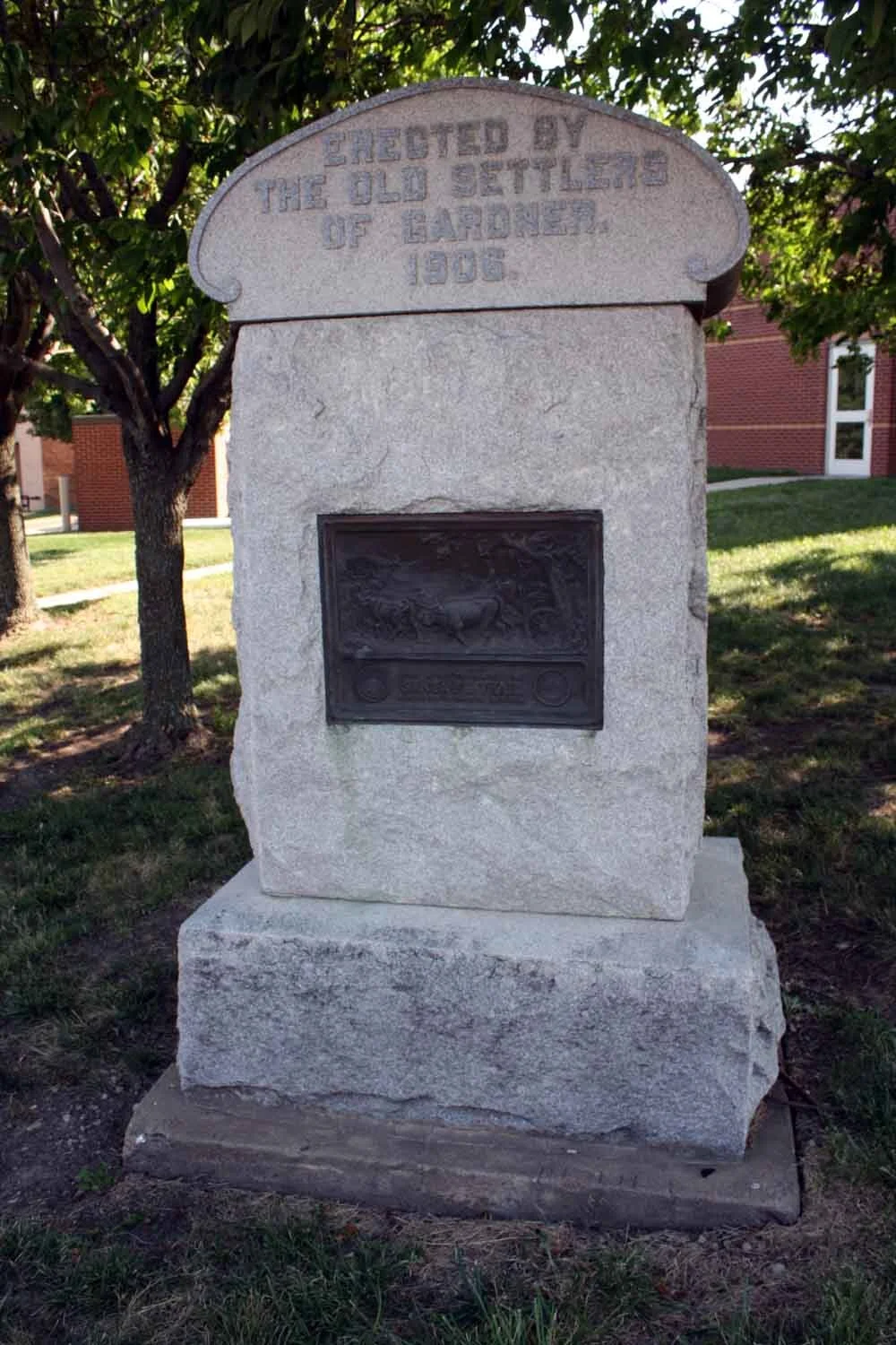
City of Gardner at Elm and Shawnee Street display a stone monument with a SFT Plaque.
Gardner Historical Society building at Main and Oak Street display old upright markers with text.
Behind the Gardner High-school building and next to the “Bray House” is 4 wayside exhibits, 3 upright NPS kiosks and wayside exhibits that were Eagle Scout projects.
Westport Route


Town of Kansas Landing (Westport Landing) is located at 2nd & Main Street, Kansas City, MO.
Ilus Davis Park is located at 10th and Oak Street. On several of its ten interpretive panels, the Monument notes the impact of the Historic Frontier Trails relating to the Western Migration on the development of Kansas City.
Other notable historic sites include:
Crown Center is on the Westport Route and goes by on the west side of Crown Center on Main St. - KCMO – Grand Avenue and Pershing Road
Plaque on SW corner of Crown Center Hotel wall at Grand Ave. and Pershing Road
Penn Valley Park is in KCMO – Memorial Drive and Liberty Memorial Mall
Wayside exhibit entitled “River to Ridge and Beyond”
18”x24” 1905 “Santa Fe Trail” bronze plaque remounted on new stone monument


Overland Park Heritage Trail is located behind Overland Park Medical Center, I-435 and Quivira at 10500 Quivira Road. You will find a 500 string of info boards, markers, statues and ground-based lights along the sidewalk about Overland Park history and culture.
Wayside exhibit “Flat Rock Creek”
Wayside exhibit – Multiple titles about Kansas City Trails
Trail site through the Park.
Nymph Island Park is located at 69th Terrace & State Line Road in Mission Hills and is on the South Branch of the Westport Route.
Wayside exhibit on stone support “The Trail Really Made this City Possible”
Unveiling the wayside at 6/14/18 dedication
A Day on the Trail is located at 80th St. and Santa Fe Drive, Downtown Overland Park. You will find 2 NPS wayside exhibits, DAR SFT monument and a commemorative bench.
Westport - Center of town is at Westport Road and Pennsylvania Avenue. Markers there are:
Marker on 1850 Albert G. Boone Store that supplied trail travelers
Marker about John Calvin McCoy who founded Westport in 1833
Upright Santa Fe Trail marker on post one block west of Boone Store
Westport Route splits into North and South Branches at Westport. Westport Route – North Branch – goes from Westport West South West to Strang Park.


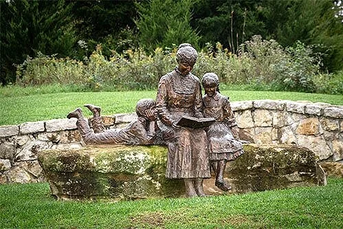
Mahaffie Stagecoach Stop and Farm is on the Westport Route and runs by the Mahaffie House and Heritage Ctr. at 1200 East Kansas City Road in Olathe, KS. Here you will find many fascinating exhibits, signs, monuments and posts including:
Wayside exhibit “Rest for the Weary”
Large sign “Mahaffie Stagecoach Stop and Farm” and three trails logos
Limestone Post with SFT logo, “James Mahaffie settled here in 1858”
Heritage Center with limestone post visible in front of the center
Large 40-feet long monumental sculpture of stagecoach, horses, emigrants and birds (Just east of the house, built about 2005)
Alexander Majors plaque – (famous trails freighter, lived locally)
Jim Bridger – (frontiersman and local resident)
Pioneer Park plaque
Large map of western U.S. on a slab showing historic trails
Another notable mention is the BNSF Railroad Bridge with many trail sculptures located in Olathe on Ridgeview Road two blocks north of Santa Fe Street and two blocks south of the Mahaffie Stagecoach Stop and Farm.
Amazing bridge with sculptures of covered wagons and teams.


Harmon Park is located on the South Branch of the Westport Route in Prairie Village, Kansas on 77th Place and Delmar Street. Here you will find many rich snippets of history on wayside exhibits, plaques, post, and you will be able to see a faint wagon swale.
Wayside exhibit entitled “Prairie Highway”, one of the very first trail waysides in the Kansas City area, dedicated about 1998.
Large plaque at shelter of Santa Fe Trail map in Johnson County
A faint swale through the park and limestone post with SFT logo
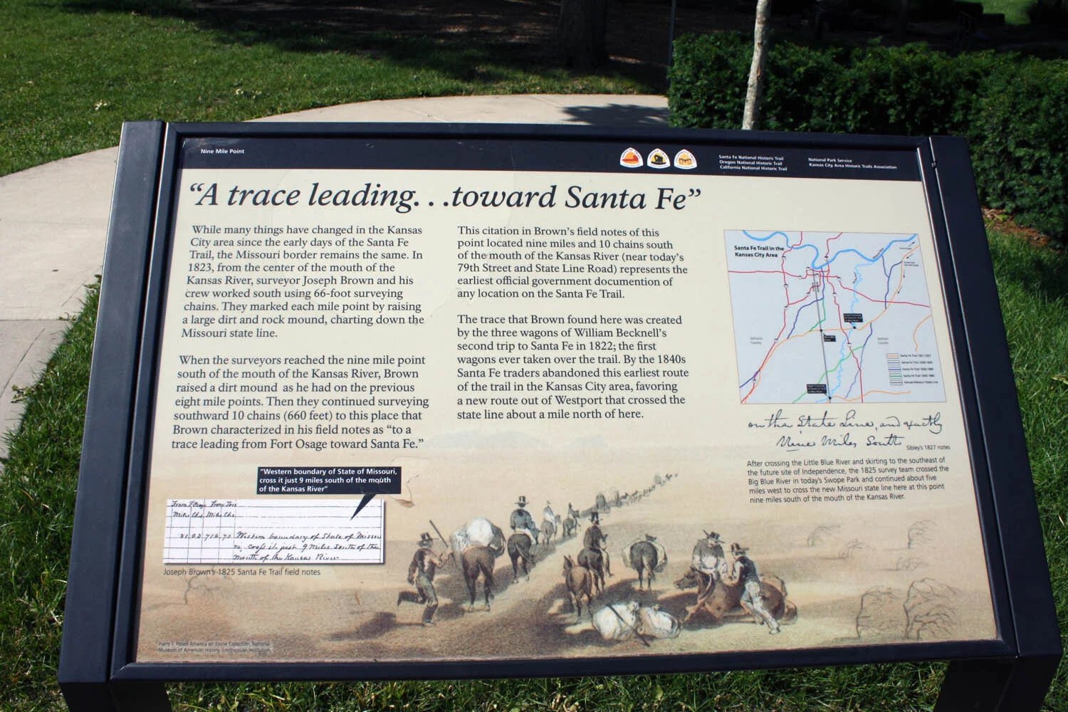

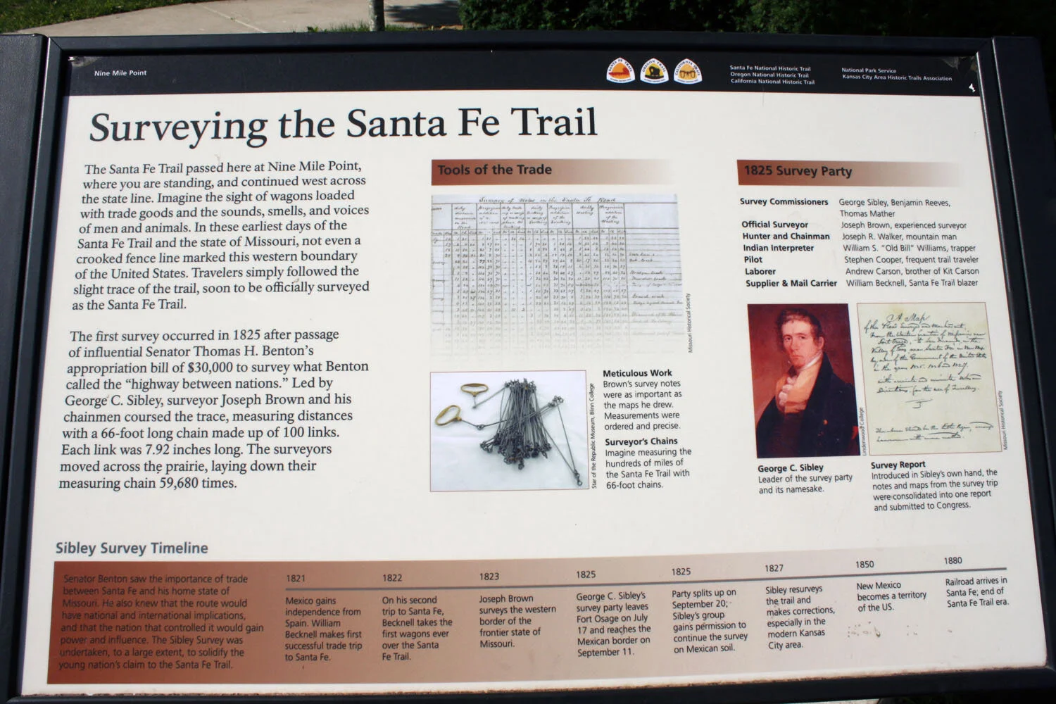
Weltner Park (Nine-Mile Point) is located at 78th & State Line Road, Prairie Village, KS. The early Santa Fe Trail crossed State Line about one block south of Prairie Village – 78th St. and State Line Road in Weltner Park. Here you will find the following exhibits:
Weltner Park site with the two waysides on dedication day
Wayside exhibit “A trace leading… toward Santa Fe”
Wayside exhibit “Surveying the Santa Fe Trail


Alcove Spring was a popular stop along the Oregon Trail near Independence Crossing in Marshall County, Kansas. Travelers along the trail gave the springs its name. You can still find the words 'Alcove Springs' carved into the hard limestone cliff. Wikipedia
Alcove Spring Historic Park is on the National Register of Historic Places and considered one of the most significant historic sites on the Oregon Trail in Kansas. it was discovered in 1846 when the Donner party were delayed by high waters on the Blue River. A 223-acre park offers a self-guided walking tour and interpretive exhibits. The trail to the spring itself is less than 1/4 mile and an easy walk. Recently, bike trails were constructed to offer additional opportunities to explore the site.
Alcove Spring is located 6 miles South of Marysville on the East River Road. Follow the highway directional signs. Visitmarysvilleks.org/attraction/alcove-spring for more information.
Contact: Alcove Spring Preservation Association, P.O. Box 98, Blue Rapids, Kansas 66411, (785) 363-7991


Pioneer Crossing Park is located at 10406 Shawnee Mission Parkway, Shawnee, Kansas. Pioneer Crossing Park and The Ft. Leavenworth Military Road split about ½ mile north and the two routes are about two blocks east and west of the Park.
Here you will find a covered wagon sculpture and six wayside exhibits:
Wayside exhibit “California Road”
Wayside exhibit “Ft. Leavenworth Military Road”
Wayside exhibit “Trail Map”
Wayside exhibit “Wagonmaster’s House”
Wayside exhibit “Gum Springs”
Wayside exhibit “Westport – Santa Fe Trail –Oregon/California Trail”


Shawnee Indian Mission is located at 53rd & Reinhardt St., Fairway, KS. Here you will find a rich history, including, a 12-acre complex of 19th-century buildings with Native American exhibits, plus living history events. Soon a New NPS wayside exhibit coming possibly in 2020 / upright marker on two posts.
Click here to watch the video about the mission.


Sapling Grove Park is located at 83rd & Grant, Overland Park, KS (original name was Comanche Park). The Westport Route North Branch was ¼ mile south.
Sapling Grove Park features several historical informational panels, created in conjunction with the National Park Service and the Kansas City Area Historical Trails Association, that tell the history of the area. You will find a beautiful park with 3 wayside exhibits.
Another notable site:
Country Club Plaza is on the Westport Route – South Branch crosses Brush Creek and continues south on Wornall Road 100 feet east of the following marker which is next to Intercontinental Hotel in KCMO on Wornall Road and Ward Parkway.
Santa Fe Trail plaque on limestone slab - 1975 by Native Sons of Kansas City


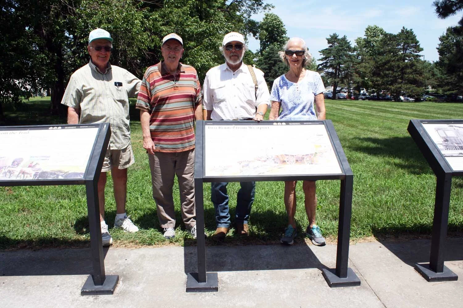
Strang Park is located at Farley Street and 88th Street Terrace, Overland Park, KS. The park is on the South Branch of the Westport Route. North Branch is one block north, intersecting together about two blocks west of Strang Park at Mastin Street (no markers there).
Here will find a beautiful park with 4 NPS wayside exhibits. Download the NPS PDF’s that show the above exhibits in perfect detail.
Wayside exhibit “Opening the Floodgates”
Wayside exhibit “Voices from the Trail”
Wayside exhibit “Wagons and Coaches…to Trains and Planes”
Wayside exhibit “Two Routes from Westport”
Picture (L-R) Ross Marshall, Dick Nelson, Gary Hicks and Lila Aamodt in front of the four waysides during a markers survey


Elm Grove Campground (also known as Caravan Grove) is now on private land. The markers site is on the Westport Route and goes Southwest ¼ mile south of the markers in Olathe at Hwy 56 and Lakeshore Drive, one mile west of Elm Grove Park and the Westport Route crossing of Cedar Creek, just one mile west of Olathe.
“George Sibley surveyed the Elm Grove campsite in an effort to find a shorter route through the region. Travelers, and later trails scholars, often confused it with the Lone Elm campsite, located 2.25 miles to the south on the same creek. Research by Johnson County resident Craig Crease documented the existence of these two distinct campsites by comparing mileage and diary entries…” (Jocogov.org)
Typical red stone DAR SFT 1906 monument on concrete base
24”x24” aluminum marker on two posts “Elm Grove Campground”
Other notable sites near the area include:
Flat Rock Creek Park – Westport Route crosses Flat Rock Creek at the Park in Lenexa at 103rd between Noland and Hauser Streets.
Wayside exhibit “Flat Rock Creek/Indian Creek Campground”
Wayside exhibit site at Flat Rock Creek
Johnson County Courthouse – Westport Route went southwest one block south of Olathe at 101 North Kansas Avenue.
Large 1907 stone monument with 1905 SFT plaque similar to others
1905 SFT plaque on above monument
*Westport Route continues southwest for five miles to Gardner Junction
The Independence Route and the Westport Route of the Santa Fe – Oregon – California National Historic Trails merge about ¼ mile north of Gardner Junction Park, which is at 183rd and Highway 56, one mile southwest of the City of Gardner.
The Santa Fe Trail continues west-southwest from there toward Santa Fe, New Mexico. The Oregon-California Trail continues west and northwest toward Lawrence and on to Nebraska and west.